

Lake Pend Oreille
Real Estate · Waterfront Homes · Buyer Guide
Idaho's largest and deepest lake — 1,152 feet down, 43 miles long, anchoring Sandpoint and the Selkirk corridor with the cleanest big-lake water and the largest annual drawdown in the region.
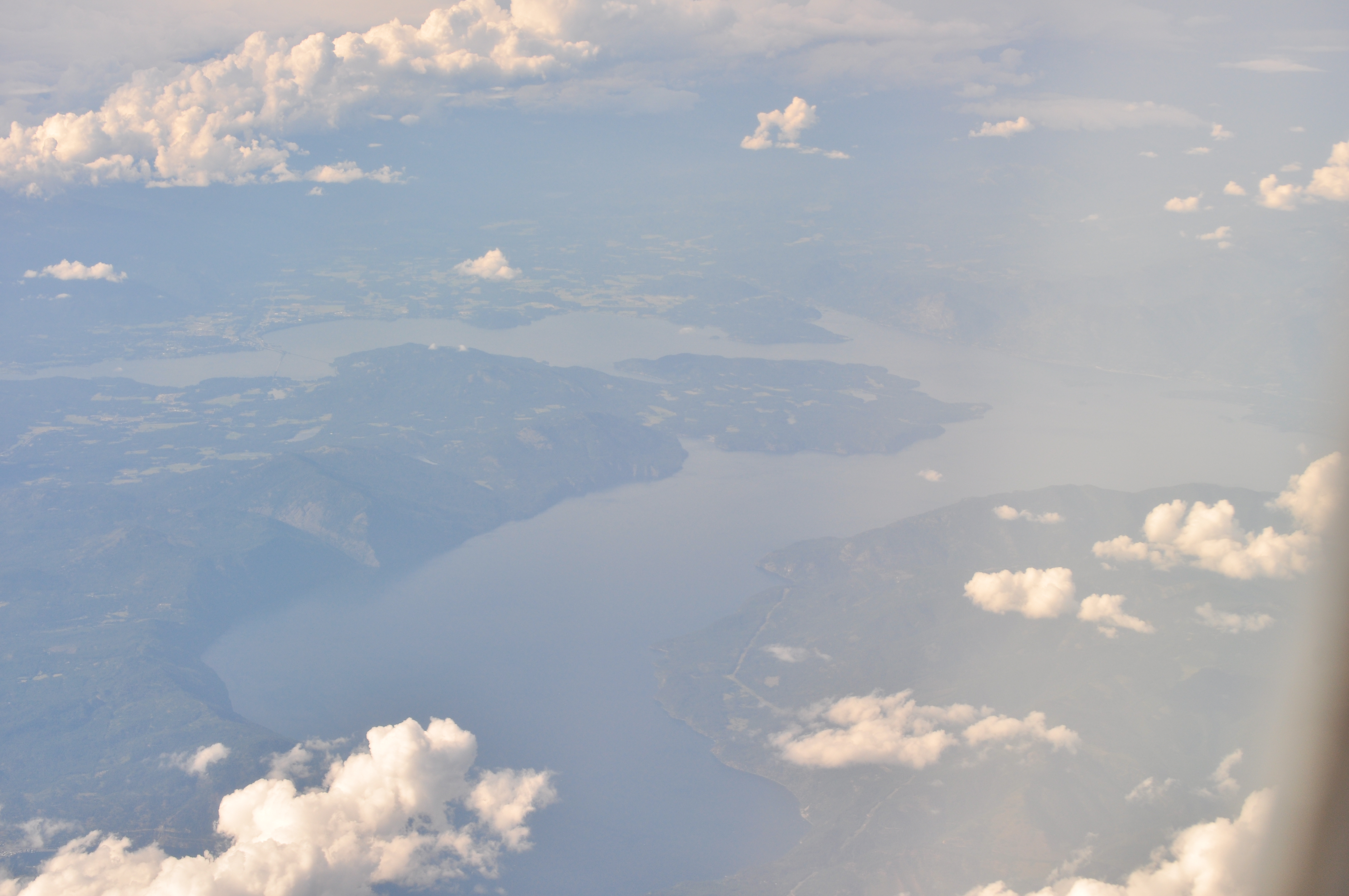
Lake Pend Oreille is a 94,000-acre glacial lake in Bonner County, Idaho — 43 miles long, with a maximum depth of 1,152 feet (fifth-deepest lake in the United States) and 111 miles of shoreline. Dock permits are issued by the Idaho Department of Lands, and the U.S. Army Corps of Engineers operates Albeni Falls Dam to drop the lake about 11.5 feet from summer full pool — the largest managed drawdown in the region. Waterfront homes typically trade between $1.2M and $5M, with estates in Dover Bay, Garfield, and Trestle Creek running $7M to $15M+.
The shoreline character is its own story. Most of it is high-bank forested with rocky coves; the walk-out sand is concentrated in a few specific places — Sandpoint City Beach on the north, Bayview and Garfield Bay on the south. The water-level swing is the largest in the region: 11.5 feet between summer full pool and the mid-November winter low, managed by the U.S. Army Corps of Engineers at Albeni Falls Dam and held into late December for kokanee spawning before refill. Docks and shoreline access need to be designed for that range.
Sandpoint anchors the year-round community — full retail, Bonner General Health, and a downtown that walks to the lake. Outside that corridor, the east shore (Hope, Clark Fork) and the south end (Bayview, Lakeview) lean seasonal and second-home. Fire-district coverage varies by parcel — Selkirk Fire underwent a JPA change in 2024 — and the dock permit pathway is IDL with lake-specific encroachment conditions. Verify both before writing.
What buyers ask about Lake Pend Oreille.
Permits, rules & permissions
What is the maximum dock length on Lake Pend Oreille, and who issues the permit?
Single-family docks follow Idaho's encroachment standards under IDAPA 20.03.04: maximum 700 sq ft of surface area, 10 ft wide, and may not extend past the established line of navigability. Permits are issued by the Idaho Department of Lands. Lake Pend Oreille has lake-specific encroachment conditions reflecting its size and the 11.5-foot annual water-level swing.Can I add sand to make a beach on Lake Pend Oreille?
Below the ordinary high water mark any placement of new material requires an IDL encroachment permit. Above the OHWM, Bonner County Title 12-711 imposes a 40-foot setback from OHWM with associated restrictions.Can I dredge or remove weeds at my private shoreline?
Mechanical dredging or weed cutting requires an IDL encroachment permit plus a Section 404 permit from the U.S. Army Corps of Engineers and a Section 401 water-quality certification from Idaho DEQ. The Idaho State Department of Agriculture coordinates the lake's Eurasian watermilfoil program. Hand-pulling is generally allowed.What herbicide or algaecide treatments are allowed?
Only EPA-registered aquatic products under Idaho DEQ's Pesticide General Permit (IDG87-0000), with the Idaho State Department of Agriculture coordinating treatments lake-wide.Are gas-powered boats allowed? Is there a horsepower limit?
Yes, gas boats are allowed and there is no horsepower cap. Idaho's statewide boating safety rules under Title 67, Chapter 70 apply.What is the no-wake zone?
5 mph within 200 feet of any shoreline, dock, swimmer, or anchored vessel per Bonner County boating regulations.Does the lake have a seasonal drawdown?
Yes — the largest in the region. The U.S. Army Corps of Engineers operates Albeni Falls Dam to lower the lake from summer full pool (~2,062.5 ft) to about 2,051 ft (~11.5-ft swing) by mid-November, held until late December for kokanee spawning before refill. Plan dock height and shoreline access for that swing.What is the shoreline setback for new construction?
Bonner County Title 12-711 sets a 40-foot setback from OHWM, with variances available. There is no general vegetation-buffer ordinance comparable to Kootenai's 25-foot Shoreline Management Area, though water-quality protections apply.Is septic permitted on waterfront, or is sewer required?
Mix. The City of Sandpoint and parts of Sagle and Hope have sewer service, where connection is required. Outlying shorelines are predominantly septic under Panhandle Health District, with drainfield setbacks of 100–300 feet from surface water.Are short-term rentals (Airbnb/VRBO) allowed?
Yes. Idaho Code §67-6539 preempts most local prohibitions, and HB 583 (effective July 1, 2026) further restricts what cities can require.
The water itself
How deep is Lake Pend Oreille?
Maximum depth is approximately 1,152 feet — the fifth-deepest lake in the United States. Average depth is around 538 feet.How big is the lake?
Approximately 94,000 surface acres (~148 sq mi), 111 miles of shoreline, and 43 miles long. Idaho's largest lake.What is the elevation?
About 2,062 feet at summer full pool.Is the lake spring-fed, river-fed, or glacial?
Natural glacial lake carved by the Cordilleran ice sheet and shaped further by the Glacial Lake Missoula floods. Fed primarily by the Clark Fork River; outflow runs through the Pend Oreille River via Albeni Falls Dam.How clear is the water?
Outstanding. Secchi-disk visibility typically runs 30–40+ feet in summer — among the clearest large lakes in the lower 48.What is the shoreline character?
Predominantly high-bank forested with rocky coves. Pockets of mid-bank walk-out sand on the south end (Bayview, Garfield Bay) and at Sandpoint City Beach.Does Lake Pend Oreille freeze?
Never completely, given the depth. Bays freeze regularly January through February. Rare main-lake partial-freeze events occur in very cold winters.Where are the public boat launches?
Sandpoint City Beach, Farragut State Park (Bayview), Garfield Bay (Bonner County), Hope, Bayview Public Launch (Kootenai County), Talache, and Trestle Creek.
Living on the lake
What's the typical waterfront price range?
Single-family waterfront generally trades between $1.2M and $5M depending on bay, frontage, and dock. Premium estates — Dover Bay, Garfield, Trestle Creek — run $7M to $15M+.How many waterfront homes sell each year?
Approximately 60–100 waterfront transactions per year across the Bonner County Lake Pend Oreille shoreline.What's nearby for groceries, schools, and medical?
Sandpoint (pop. ~9,000) is the central service hub with Bonner General Health (Level IV trauma). Schools are Lake Pend Oreille School District 84.What is the property tax rate?
Bonner County's 2025 average effective rate is approximately 0.616%. Idaho's homeowner exemption — 50% of value up to $125,000 — applies to a primary residence only.How is fire protection structured around the lake?
Selkirk Fire, Rescue & EMS (career plus volunteer) covers the Sandpoint/Sagle/Hope corridor; Sandpoint Fire left the joint powers agreement in 2024, so verify by parcel. Outlying shoreline is served by Westside, Sam Owen, Northside, Schweitzer, and Sunset fire protection districts.Is broadband available lakefront?
Ziply Fiber and Northland Communications fiber reach much of the populated shoreline. Starlink is common on remote stretches.Year-round community or seasonal?
Roughly 55/45 year-round to seasonal. The Sandpoint corridor is primarily year-round; the remote east shore (Hope, Clark Fork) and the south end (Bayview, Lakeview) lean more seasonal.
Thinking about Lake Pend Oreille?
Send a note. We'll pull comps for this specific shoreline and tell you what's quietly off-market.