

Lake Coeur d'Alene
Real Estate · Waterfront Homes · Buyer Guide
The signature lake of North Idaho — 25 miles of deep, clear water with luxury waterfront, downtown access, and four-season recreation.
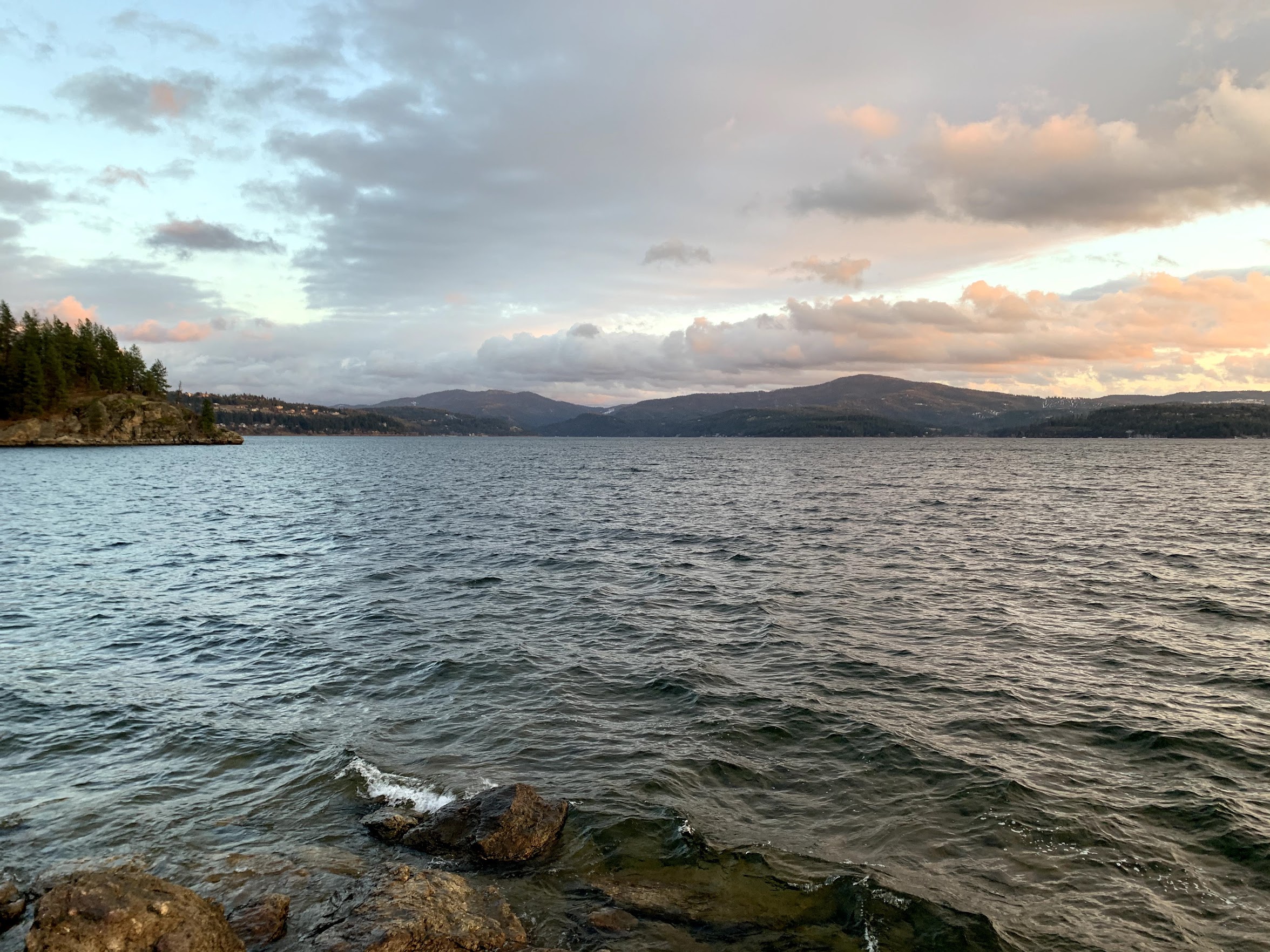
Lake Coeur d’Alene is a 30,000-acre glacial lake in Kootenai County, Idaho — 25 miles long, with a maximum depth of about 220 feet and 109 miles of shoreline. The north third and the City of Coeur d’Alene shoreline are permitted by the Idaho Department of Lands; the south two-thirds and the lower St. Joe fall under the Coeur d’Alene Tribe Lake Management Department. Waterfront homes typically trade between $1.5M and $5M, with estates reaching $7M to $20M+ in Casco Bay, Gozzer Ranch, and along Resort Drive.
This guide stays close to the questions buyers actually ask — dock authority, drawdown, septic, what kind of beach the regulators will let you keep. Numbers are accurate as of mid-2026; regulations change quietly. The one rule that stays the same is to verify parcel-level specifics before writing anything firm into an offer.

What buyers ask about Lake Coeur d'Alene.
Permits, rules & permissions
What is the maximum dock length on Lake Coeur d'Alene, and who issues the permit?
Single-family docks are sized by Idaho's encroachment standards rather than a single length cap: maximum 700 sq ft of surface area, 10 ft wide (excluding any slip cutout), and may not extend past the established line of navigability. Permits are issued by the Idaho Department of Lands on the north third and the City of Coeur d'Alene shoreline, and by the Coeur d'Alene Tribe Lake Management Department on the south two-thirds and the lower St. Joe (per Idaho v. United States, 533 U.S. 262, 2001). Tribal waters have been under a restrictive posture since January 1, 2022 — new dock construction is heavily conditioned; replacements of existing permitted structures remain routine.Can I add sand to make a beach on Lake Coeur d'Alene?
Below the ordinary high water mark (2,128.7 ft NAVD88) any placement of new material is an encroachment that requires an IDL or Coeur d'Alene Tribal permit. Above the OHWM, Kootenai County Code 8.7.111 imposes a 25-foot Shoreline Management Area with disturbance restrictions. New sand beaches on the south basin are routinely denied or heavily conditioned under current Tribal policy; confirm parcel jurisdiction before promising anything.Can I dredge or remove weeds at my private shoreline?
Mechanical dredging or weed cutting requires an IDL or Tribal encroachment permit plus a Section 404 permit from the U.S. Army Corps of Engineers and a Section 401 water-quality certification from the Idaho Department of Environmental Quality. Hand-pulling nuisance plants in a swim area is generally allowed without a permit. Herbicide use requires Idaho's Pesticide General Permit (IDG87-0000) and advance public notice.What herbicide or algaecide treatments are allowed?
Only EPA-registered aquatic products may be applied, and only under coverage of Idaho DEQ's Pesticide General Permit (IDG87-0000). On Tribal waters, application requires Tribal authorization plus EPA NeT notice of intent. Public notice is mandatory before treatment.Are gas-powered boats allowed? Is there a horsepower limit?
Yes, gas boats are allowed and there is no horsepower cap. Idaho's statewide boating safety rules (Title 67, Chapter 70) apply, including BUI, life-jacket, and registration requirements.What is the no-wake zone?
5 mph and a wake no greater than 6 inches within 200 feet of any shoreline, dock, swimmer, or anchored vessel, per Kootenai County Code Title 6, Chapter 2. An additional 300-foot no-excessive-wake zone applies on Lake Coeur d'Alene.Does the lake have a seasonal drawdown?
Yes. Avista's Post Falls Dam lowers the lake roughly 7.5 feet from summer full pool (~2,128 ft NAVD88) starting the day after Labor Day. Winter low sits near 2,120.5 ft and the lake refills to natural elevation by January. Plan dock height and shoreline access for that swing.What is the shoreline setback for new construction?
Kootenai County Code 8.7.111 establishes a 25-foot Shoreline Management Area landward of the OHWM with restrictions on disturbance, fertilizer, and chemical storage. Principal-structure setback is typically 40 feet from OHWM in residential zones; verify zoning and the specific environment designation on the parcel.Is septic permitted on waterfront, or is sewer required?
Inside the City of Coeur d'Alene and several major bays served by HARSB or local improvement districts, sewer connection is required where available. Outside those service areas, septic is permitted under Panhandle Health District rules, with drainfield setbacks of 100–300 feet from surface water depending on soil permeability.Are short-term rentals (Airbnb/VRBO) allowed?
Yes. Idaho Code §67-6539 preempts most local prohibitions, and HB 583 (signed March 2026, effective July 1, 2026) further restricts what cities can require. The City of Coeur d'Alene's 2017 registration ordinance remains in force for permit and operating standards but cannot ban STRs in residential zones.
The water itself
How deep is Lake Coeur d'Alene?
Maximum depth is roughly 220 feet near the south basin; average depth is about 120 feet. It's one of the deeper natural lakes in the Lower 48.How big is the lake?
Approximately 30,000 surface acres, 109+ miles of shoreline, and 25 miles long north-to-south — the second-largest lake in Idaho, large enough to support distinct sub-markets across the north basin, west shore, east shore, and south basin.What is the elevation?
About 2,128 feet at summer full pool (NAVD88).Is the lake spring-fed, river-fed, or glacial?
All three influences. The basin is glacial in origin (Cordilleran Ice Sheet), the inflow is dominated by the Coeur d'Alene and St. Joe rivers, and the outflow is regulated by Post Falls Dam.How clear is the water?
Secchi-disk visibility typically runs 12–20 feet in the main basin mid-summer. Clarity is lower in the southern reaches where the St. Joe River enters. Long-term IDEQ and USGS monitoring shows the main basin trending stable.What is the shoreline character?
Mixed. Much of the east shore is high-bank forested; the west shore is mid-bank residential with sandy pockets at Sanders Beach and City Beach; Tubbs Hill is rocky basalt. Bays vary widely — Cougar Bay is shallow and reedy, Mica Bay deep and walk-out.Does Lake Coeur d'Alene freeze?
Rarely in full. The last complete freeze was 1985; near-complete ice in 1996. The bays — Cougar, Mica, Wolf Lodge — routinely ice over January through February. The main basin's depth keeps it mostly open even in cold winters.Where are the public boat launches?
Fifteen-plus ramps including Blackwell Island (BLM), Mineral Ridge (BLM), Higgens Point, 3rd Street (City), Mica Bay, Carlin Bay, Harrison, Sunup Bay, Powderhorn, and Conkling Park. Some are seasonal — check Idaho Fish & Game and Kootenai County Parks for status.
Living on the lake
What's the typical waterfront price range?
Single-family waterfront generally trades between $1.5M and $5M depending on bay, frontage, and dock. The luxury tier — CDA Resort Drive, Casco Bay, Gozzer Ranch — runs $7M to $20M+, with select estates above.How many waterfront homes sell each year?
Approximately 40–80 waterfront transactions per year on Lake Coeur d'Alene proper, depending on the cycle. The Coeur d'Alene Regional Realtors MLS is the authoritative source.What's nearby for groceries, schools, and medical?
The City of Coeur d'Alene (pop. ~57,000) sits at the north end with full retail and services. Kootenai Health in CDA is a Level III trauma center. Coeur d'Alene School District 271 covers the city and most of the lake; Harrison and Worley schools serve the south end.What is the property tax rate?
Kootenai County's average effective rate is approximately 0.541% (2025). Idaho's homeowner's exemption — 50% of value up to $125,000 — applies to a primary residence only. A second home or recreational property does not receive the exemption.How is fire protection structured around the lake?
Multiple districts. The City of Coeur d'Alene Fire Department (career) covers the city shoreline; Mica-Kidd Island FPD, Worley FPD, and Wolf Lodge FPD cover the rest. Populated bays generally have career or career-volunteer hybrid response; outlying stretches are volunteer.Is broadband available lakefront?
Ziply Fiber and Spectrum (cable) reach most of the populated shoreline. TDS Fiber is expanding. Starlink works well as a redundant or primary option in remote bays.Year-round community or seasonal?
Both, split roughly 50/50 by parcel count. The north third — city, urban corridor — is increasingly year-round. The southern bays (Mica, Carlin, Squaw, Casco) lean second-home and recreational, though the trend each year is toward more primary residence.
Thinking about Lake Coeur d'Alene?
Send a note. We'll pull comps for this specific shoreline and tell you what's quietly off-market.